
Walk a Dolton Street Record
A sound Dolton street directory search starts with the place, not a guessed name. Official records can identify a tax parcel, an assessed owner, a tax-mail recipient, parties to recorded deeds, and people named in a dated permit or old directory. Each fact has its own date and scope. None is an open roster of all occupants. Keep the address exactly as first found, including its direction and unit, because changing the query too soon can hide the reason two systems disagree.
- Standardize the mailing line with USPS, then retain the original form beside it.
- Open CookViewer by address or intersection. Save the PIN, parcel shape, municipality, township, and map date.
- Run the Assessor address search. Compare its property location and property card with the mapped parcel.
- Use the PIN in the tax portal and Clerk Recordings System. Save document numbers and dates before ordering an image.
- For a past household, compare a dated directory, newspaper, Census release, or Sanborn sheet. For a defined village file, use Dolton FOIA.
The chain is address to parcel, parcel to PIN, PIN to assessment and tax files, then PIN or legal description to recorded instruments. A name found at the end is evidence from that source on that date. It is not automatic proof of current residence.
Search Dolton Assessor Addresses
The Cook County Assessor address search is the main assessment entry for a Dolton street. It requires a house number, street name, city, and CAPTCHA. Direction and unit have separate controls. Omit a designation such as “Street” or “Avenue” from the street-name field. A known PIN can be entered as 14 digits, while neighborhood search uses township, neighborhood, and property class.
| Search route | Fields to enter | Best use |
|---|---|---|
| Address | House number, direction, street name, unit, city, CAPTCHA | One known Dolton location |
| PIN | 14-digit parcel number, CAPTCHA | Exact tax parcel |
| Neighborhood | Township, neighborhood, property class | Comparable assessment group |
| Advanced | Address range, partial PIN, township, year, class, appeal fields | Broader street research |
A property detail may show assessment values, building traits, permits, exemptions, appeal history, and recent neighborhood sales. Its property location is not necessarily the legal or postal mailing address. That warning is central to a street directory because the mailing recipient and parcel location may differ.
The official Dolton address-search screen shows how the fields are divided.
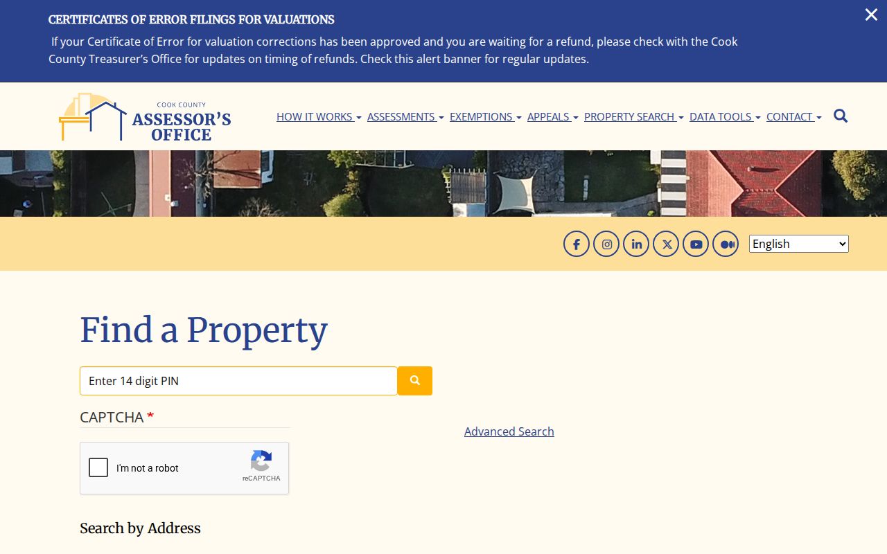
Separate fields for direction, unit, and city help diagnose why a broad address string fails.
Range Search on Dolton Streets
The Assessor Advanced Search adds address ranges, partial PINs, township, year, property class, and appeal-related fields. It can reveal parcels within a numbered run without claiming that the assessed names are the people inside each building. Record the filter set with the result. Dolton lies in Thornton Township, but the municipal, township, postal, and election labels should remain distinct.
The captured advanced address interface is useful when one exact street number is unknown.
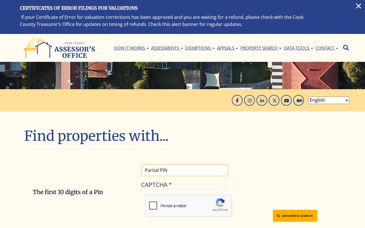
The broader controls make this a range tool, while the PIN remains the safer key for one parcel.
Once a result is open, the Assessor property-detail guide explains the card fields.
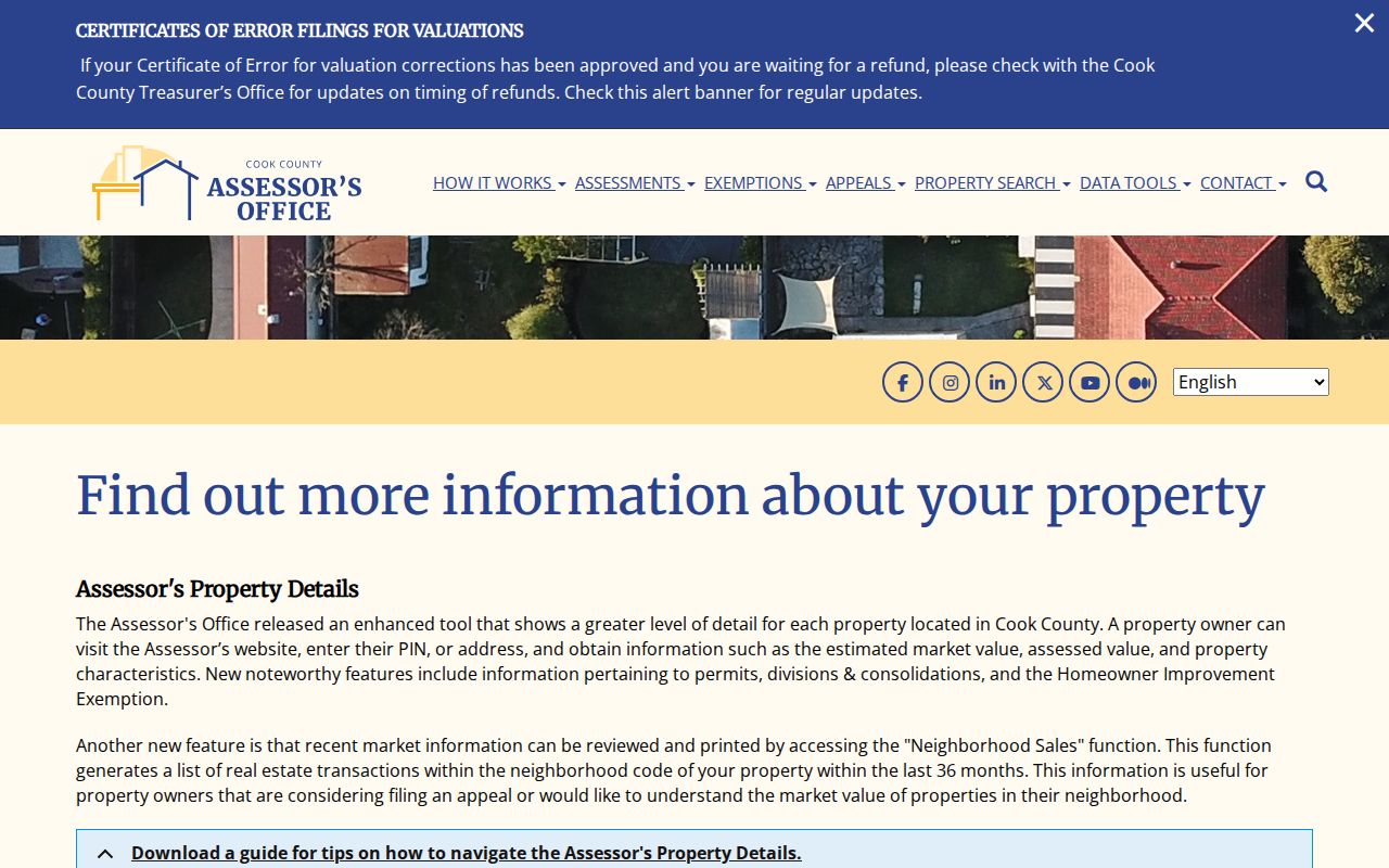
Building facts, permits, exemptions, and appeals add dated context, but do not establish an occupant list.
Map Dolton Streets in CookViewer
CookViewer accepts an address, intersection, and several PIN formats. Its All, Parcel, PIN, Parcel Address Locator, and Address Locator modes lead to parcel geometry and data panels. A selected result can show municipality, township, zoning, assessment history, building details, imagery, and district layers. Results may be selected with a click, rectangle, or polygon and exported to CSV or Excel.
Nearby Search and Compare Properties are good for geographic context. Layers include flood, school, library, park, political, tax, and zoning boundaries. They show how parcels relate, not who occupies them. CookViewer displayed a May 28, 2026 release and a historical parcel archive from 2000 through the current year. The archive is not a full title chain.
Note: Save the map release, selected layer, PIN, and search date so another person can reproduce the same Dolton street result.
Decode Dolton Street Numbers
Dolton’s municipal code gives this street directory a rare local tie-breaker. Section 153.004 uses State Street as the east-west baseline, continues Chicago numbering for north-south streets, advances blocks in 100-number increments, and sets an odd/even convention. Rear premises also receive numbers. The Village Atlas is the official reference.
When a permit, deed, tax bill, or old directory carries a disputed number, the Village Clerk can issue a free certificate of proper number. Keep the old form and the confirmed form together. No complete official renaming or renumbering timeline was found, so the Atlas, plats, legal description, and PIN should bridge a gap instead of an invented date.
- Parcel
- A mapped unit used for assessment and tax records.
- Situs address
- The property-location label, which may differ from a postal or tax mailing line.
- Plat
- A recorded map dividing land into lots, blocks, streets, or easements.
- Criss-cross directory
- A dated directory arranged by address or phone rather than only by surname.
Dolton Records Arranged by Street
The official address sources use different clocks. The Assessor reflects an assessment record, the tax portal reflects billing, Recordings reflects an accepted instrument, a permit reflects an application or inspection event, and a historical directory reflects publication. A useful Dolton street directory preserves those dates rather than forcing the entries into one current-household claim.
| Record | Keeper | What the street result shows | Access |
|---|---|---|---|
| Assessment and tax | Cook County Assessor and Treasurer | Property location, parcel traits, mailing and tax history | Free online search |
| GIS parcel map | Cook County GIS | PIN, parcels, zoning and public districts | Free CookViewer |
| Deeds and liens | Cook County Clerk Recordings | Parties, instrument type, date, PIN and legal description | Free index; some copies ordered |
| Voter status | Illinois elections system | One submitted registration match for its stated purpose | Restricted lookup, not a street list |
| Permits and inspections | Village of Dolton | Application event, work, applicant and trade details | Known report IDs or narrow FOIA |
The voter form requires a first and last name, birth date, ZIP, street number, and a street selected after ZIP validation. It cannot be browsed as a resident list. Illinois also restricts voter-file access and use. A tax or deed name must never be converted into a voter claim through repeated guesses.
Trace Deeds Along Dolton Streets
The former Recorder of Deeds merged into the Cook County Clerk on December 7, 2020. The current route is the Clerk Recordings System. Start with the parcel PIN. Then try the address, grantor or grantee, document type, date range, or legal description. A grantor gives or releases an interest; a grantee receives one. Record the document number, recorded date, instrument type, parties, PIN, and legal description before buying an image.
The portal displayed “Documents Indexed Through” August 6, 2026 during research. That live date belongs in saved notes because a later filing may not yet appear. Some plats, easements, declarations, dedications, annexation documents, and related items cannot be bought online and may need an office request. A legal-description search can still work after a parcel split, consolidation, or number change defeats the street address.
Note: A deed records an instrument affecting title; it does not state that each named party occupied the Dolton address.
Compare Dolton Tax Address Clues
The Cook County Property Information portal accepts a PIN or house number, street, unit, city, and ZIP. It may link five-year tax bills, deeds and liens, exemptions, refunds, appeals, and tax-sale information. The Treasurer can show a longer installment and exemption history. These time-series facts may bracket a transfer, yet the taxpayer and mailing recipient can differ from both titleholder and occupant.
The official property and tax search illustrates the address-to-tax route.
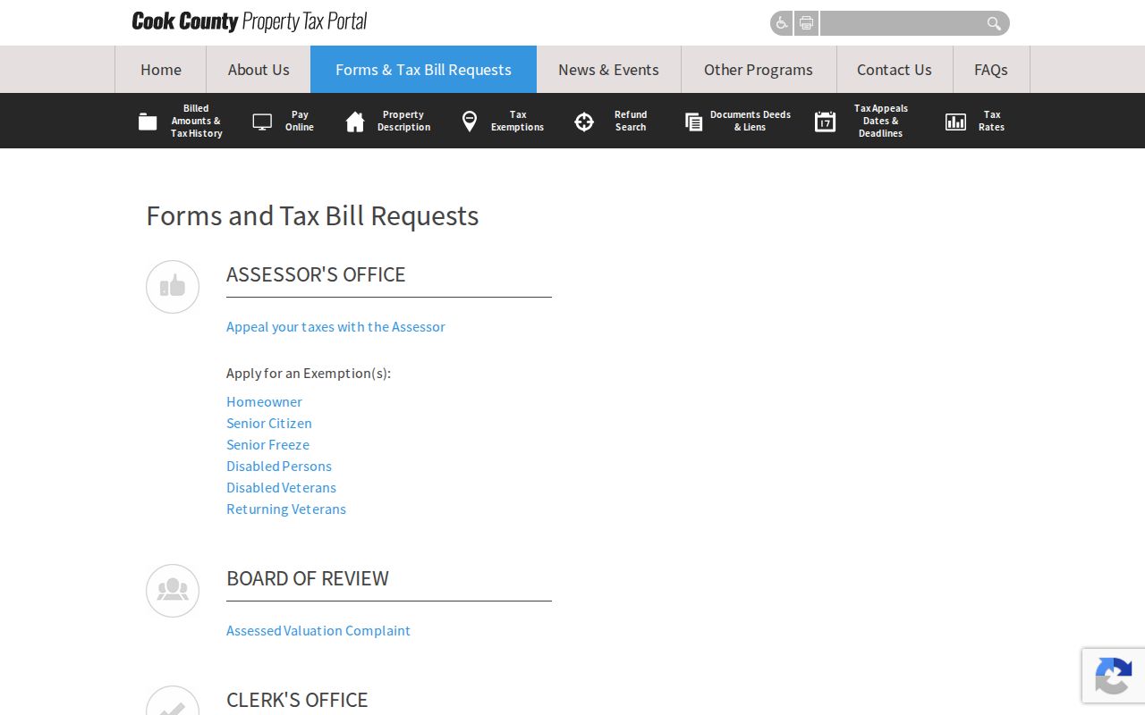
Compare its mailing field with the Assessor property location and USPS line instead of treating them as interchangeable.
Find Dolton Permit Address Files
A Dolton permit application can name the property address, applicant, proposed dates, cost, work type, and contractors by trade. That evidence dates an application and may explain a change seen on a property card or map. It does not prove the work was completed or that the applicant lived there. The public inspection report lookup needs an inspection number and passcode from the inspector, so it is not an open by-address index.
When those identifiers are unknown, request a defined record through the Village Clerk or Dolton GovQA. Give the address, department, record type, and date range. The local Clerk page states a five-business-day response framework, with a possible written extension, and the first 50 black-and-white letter or legal pages free before the listed per-page charge.
The Village permit and inspection route leads to applications and record resources.
The page is a request path for a specific address event, not a list of current residents.
Read Past Dolton Addresses
Older address evidence belongs to a specific year. Newberry verifies Dolton directory runs for 1922–1925 and 1928–1929, while regional holdings include telephone books and local files. Sanborn maps supply building snapshots for 1897, 1911, and 1950. A criss-cross entry can connect a name with a street at publication time, but it may omit units or use an older number.
Use the full historical shelf through the Dolton city directory collections. For one street, preserve the directory spelling and page, compare the closest Sanborn sheet, then bridge to a present parcel with the Village Atlas, plat, PIN, or legal description. That method respects the gap where no official complete renumbering timeline was found.
Limits of a Dolton Street Directory
No official open Dolton utility-account directory, DMV address lookup, public occupant list, or general resident-by-street roster was found. The Assessor does not expose a name-first owner search. CookViewer is a mapping aid, not a survey or title record. Tax screens may lag, and their mailing names can point elsewhere. Voter lookup serves a submitted voter’s status question and is not a browseable street roll.
Commercial address compilations can be stale or merge different people. Official records are better because their keeper, date, fields, and limits can be cited, but even official sources answer only narrow questions. Report that a record shows a named role as of a date. Do not publish a household roster from inference.
Lawful use. Use Dolton address records only for a lawful personal purpose. Never use repeated searches or address details to stalk, harass, intimidate, or harm anyone.
Resolve Dolton Address Mismatches
One building can appear in several official forms. USPS supplies a delivery line. The Assessor supplies a property location. The Treasurer keeps a tax mailing address. The Clerk indexes a legal description and recorded PIN. A directory may preserve an older abbreviation or omit an apartment. Treat each as a separate field. First compare the raw address, standardized postal line, Assessor direction and unit, CookViewer PIN, and legal description. Then decide which key belongs in the next portal.
A parcel split, consolidation, condominium structure, annexation, corner entrance, or rear number can break a simple street match. Search CookViewer by intersection if the address fails. Try the PIN with and without dashes where accepted. Move to section, township, range, subdivision, block, and lot in the Clerk Advanced Search when the number has changed. A certificate of proper number can settle the municipal label, but it does not rewrite a deed or postal record.
Which address is “right”? The answer depends on the task. USPS is strongest for delivery, the Village Atlas for a proper municipal number, CookViewer for parcel geometry, the Assessor for assessment characteristics, the tax portal for billing, and Recordings for filed instruments. State the system and date instead of silently replacing one address with another.